B.C. flooding closes roads, cuts power, prompts state of emergency
Credit to Author: Tiffany Crawford| Date: Sat, 01 Feb 2020 22:16:18 +0000
B.C.’s River Forecast Centre has issued a flood watch for some parts of the province’s South Coast, as flooding in several communities caused road closures, power outages, and prompted a local state of emergency on Vancouver Island.
As of Saturday morning, the North Shore and Metro Vancouver remained under the alert, posted Friday afternoon. Areas of concern include the Coquitlam River, Alouette River, Kanaka Creek, and MacKay Creek. The western and southern parts of Vancouver Island are also on alert for flooding.
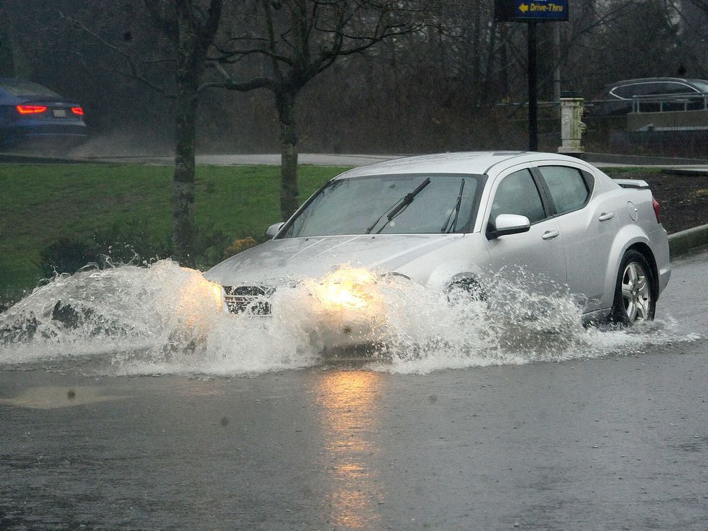
An atmospheric river pounded the South Coast on Friday, and overnight, with the heaviest rainfall measured on the west coast of Vancouver Island and along the North Shore Mountains.
Some rivers flooded, and on Vancouver Island a local state of emergency was declared in Cowichan Valley.
A statement from the Cowichan Valley Regional District says widespread flooding forced more than two dozen residents to evacuate early Saturday as key transportation corridors were cut off by rising flood water.
The district says in a statement that about 28 evacuated residents from North Cowichan and the Halalt First Nation were staying at the local community centre.
In Coquitlam, thousands of BC Hydro customers were without power after the rainstorm brought some power lines down Friday night.
BC Hydro crews were also dealing with the Alouette Reservoir in Maple Ridge, which reached capacity Saturday, for the first time since 1995.
Tanya Fish, a spokesperson for BC Hydro, said despite crews’ efforts to discharge water from the reservoir, the extremely heavy rain caused water from the reservoir to be released over the spillway into the Alouette River.
However, she said the total amount of water being discharged to Alouette River is expected to remain the same, as crews reduce discharge from a controlled gate.
“As the heavy rain from last night has subsided, local inflows into the river downstream of Alouette Dam are receding and under the current weather forecast, we do not anticipate water levels on the river to go above peak levels observed overnight,” said Fish, on Saturday afternoon.
“We are asking the public to use caution around the Alouette River and be aware that water levels may change throughout the day.”
Several roads were closed because of washouts on Saturday, according to Drive BC, including Highway 1 on Vancouver Island. The southbound lane was closed because of flooding at Exit 6 in Saanich. Highway 1 was closed in both directions about four kilometres north of Duncan to Chemainus, but it has since reopened.
Hundreds of skiers and snowboarders were trapped overnight at Sasquatch Mountain Resort after heavy rain and a landslide washed out Hemlock Valley Road in Agassiz.
The resort said, in a Facebook post, that the slide had left the road impassable to vehicles in both directions. The mountain suspended all skiing and said it was serving food to guests that had to stay on the mountain.
A spokesperson for the resort has not yet returned calls, and it’s unclear where the people are staying or how long they will be stranded.
Hemlock Valley Road north of #ChilliwackBC currently CLOSED due to rocks on the road. Assessment in progress, no detour available
Golden Ears Park Road was also closed because of water damage from the storm, according to a tweet from Alouette Parks.
#GoldenEars Park road will be closed until we complete an assessment of overnight water damage from the #BCStorm. There is at least one washout with the road surface undercut. We will update asap. pic.twitter.com/3tNb5XY2Fi
Transit service to Ladysmith and Chemainus will resume now that highway 1 is open.
Transit will not service Chemainus road between Crofton and Chemaninus or Halalt due to continued flooding.
Highway 1 was also closed because of rock slides from Lytton to Yale, and at Spences Bridge, 19 kilometres south of Cache Creek.
In Maple Ridge, 112 Avenue east of 240 Street was closed due to a slide caused by the intense rain. The city posted on Twitter that the street would be closed until crews were able to remove the debris and stabilize the slope.
We're asking citizens to stay away from areas impacted by the heavy rainfall and refrain from moving or driving around barricades. While your vehicle might be able to traverse the area, your wake can erode roads and cause property damage to adjacent properties. Be safe. pic.twitter.com/vOxDLfsCXx
Meantime, a rainfall warning that was in effect has been lifted and a much drier day was expected on Saturday. Environment and Climate Change Canada forecasted a mainly cloudy, but windy day, with a chance of showers clearing up near noon, and some sunny breaks.
The agency posted rainfall totals on Saturday, showing that many parts of Metro Vancouver exceeded 100 mm since Thursday, including Abbotsford which saw 119 mm and Pitt Meadows, which record 138 mm. Squamish was drenched in 166 mm, while Vancouver had nearly 80 mm.
Rainfall warnings have been ended for most of the south coast, but continue for Hope and the Fraser Canyon. Here's a summary of some rainfall totals up to 4 am today. https://t.co/WpF9mS1RPM #BCstorm pic.twitter.com/GUTyAYOZng
The River Forecast Centre said that while some snowmelt was expected during this weather event, snowpack at higher elevations should absorb the water.
Another cold front is moving across the region this weekend, and freezing levels are expected to rise, according to Matt MacDonald, a meteorologist with Environment and Climate Change Canada.
On Saturday, the temperature was forecast to drop to 4 C in the afternoon with an overnight low of zero. Then there is a chance of snow at higher elevations on Sunday.
Crazy front passing at my moms place in Sidney #BCStorm #PinappleExpress pic.twitter.com/LGkcCmTpvp
The speed of Lynn Creek this morning is pretty scary. #bcstorm pic.twitter.com/aQAYfvYRdN
With files from The Canadian Press
More to come…