Vancouver Weather: Wind and snow, changing to rain later
Credit to Author: Tiffany Crawford| Date: Fri, 10 Jan 2020 14:48:58 +0000
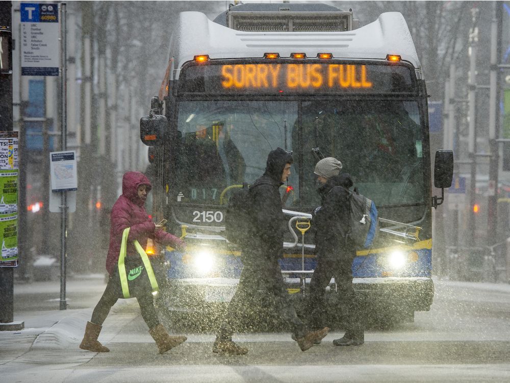
VANCOUVER, B.C.: Friday, Jan. 10. Vancouver residents woke up Friday to snow in Metro Vancouver. Snow and wind warnings remain in effect for the region as a winter storm moves across the South Coast. Environment and Climate Change Canada says Vancouver could see up to 10 centimetres of snow before it changes to rain, with a high of 3 C. It’s also going to be a blustery one, with wind gusts of up to 70 km/h or 90 km/h by the water. Overnight, there’s more rain on the way, with up to 25 millimetres expected, and the temperature remaining at around 3 C. On the weekend, showers are expected Saturday morning but that should change to a mix f sun and cloud, with wind, and a high of 3 C. Overnight, there could be some more snow flurries or rain with a low of 1 C and then Sunday looks like periods of rain or snow with a high of 4 C. Next week starts out cold, with a chance of snow Monday and a high of – 1 C. Overnight Monday, the mercury takes a plunge to a low of – 9 C. On Tuesday there’s a good chance of snow, with a high of – 2 C and an overnight low of – 7 C.
Today: Snow at times heavy changing to rain this afternoon. Snowfall amount 5 to 10 cm. Rainfall amount 5 to 10 mm. Wind southeast 40 km/h except gusting to 70 near the water this morning and early this afternoon. High plus 3 C.
Tonight: Rain. Amount 15 to 25 mm. Windy this evening. Temperature steady near plus 3 C.
Tomorrow: A few showers ending in the morning then a mix of sun and cloud. Wind northwest 30 to 50 km/h except gusting to 80 near the water in the morning. Temperature steady near plus 3 C. UV index 1 or low.
Source: Environment and Climate Change Canada
Zoom in and out to to find incidents of note or to peek at a traffic camera.